Filter By:
Media/Resources

$29.99
The 4th edition of the Big Blue Book of Bicycle Repair is updated with the latest information, procedures and techniques and covers everything from minor adjustments to complete overhauls.
- The perfect reference guide for nearly any level mechanic and every bike
- Features clear, step-by-step instructions, high quality color photos and useful charts and graphs to thoroughly explain and demonstrate hundreds of repairs
- Written by one of the world’s leading authorities on bicycle repair and maintenance, Park Tool Director of Education, Calvin Jones
$10.00
(Note: This item $3 Shipping in USA!)
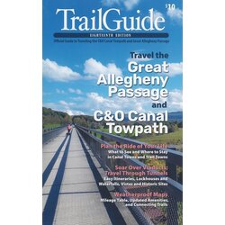
This TrailGuide is the official, authorized guidebook for traveling the Great Allegheny Passage and C&O Canal Towpath, covering two scenic trails -- and one amazing journey between Pittsburgh and Washington, D.C. It's packed with mile-by-mile trail descriptions; town maps and directories; and itineraries for day trips, weekends, and thru-rides. Included is a two-sided, weatherproof 7.625” x 24.75” map, showing both trails and hundreds of features. TrailGuide includes a mileage chart, a plan-your-trip checklist, suggestions on photo ops, options for camping, and a list of parking and trail access points.
$18.99
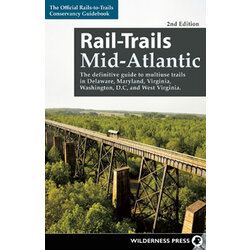
Across the country, more than 1600 unused railroad corridors have been converted to level, public, multiuse trails, where people can enjoy a fitness run, a leisurely bike ride, or a stroll with the family. In this updated guide in the popular series, the Rails-to-Trails Conservancy presents the Mid-Atlantic region's finest rail-trails plus other great multiuse trails.
Rail-Trails Mid-Atlantic covers 60 trails in Delaware, Maryland, Virginia, West Virginia, and Washington, D.C. Many rail-trails are paved and run through the most scenic parts of town. Others, such as the 34-mile Virginia Creeper National Recreation Trail, travel along dense forests, open fields, and lush waterways. Some explore the area's history, such as Maryland's 13-mile Baltimore and Annapolis Trail. Tour the nation's capital, visit the site of an historic Civil War battle, and enjoy the serenity of the rural countryside along the Mid-Atlantic's many great multiuse trails.
This full-color book includes succinct descriptions of each trail from start to finish, plus at-a-glance summary information indicating permitted uses, surface type, length, and directions to trailheads for each trail. Every trip has a detailed map that includes start and end points, trailhead, parking, restroom facilities, and other amenities.
$18.95
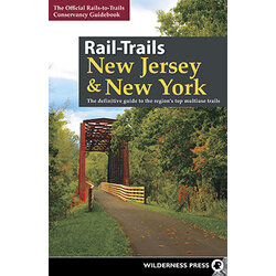
All across the country, unused railroad corridors have been converted into public multiuse trails. Here, the experts from Rails-to-Trails Conservancy present the best of these rail-trails—as well as other multiuse pathways—in New Jersey and New York. You’ll appreciate the detailed maps for each trail, plus driving directions to trailheads. Quick, at-a-glance icons indicate which activities each trail can accommodate, from biking to fishing to snowmobiling. Best of all, the precise descriptions are written by rail-trail experts, so you know it’s information that you can rely on!
Many rail-trails are paved and connect communities, such as New Jersey’s 6.5-mile Pleasantville to Somers Point Bike Path. Some feature dramatic scenery, like the Ken Lockwood Gorge on New Jersey’s 11.3-mile Columbia Trail or the ultra-urban, lower Manhattan views from New York’s elevated High Line. Whether you’re on feet, wheels, or skis, you’ll love the variety in this collection of multiuse trails—from beautiful waterways and scenic areas to the hustle and bustle of the states’ urban centers!
$17.95
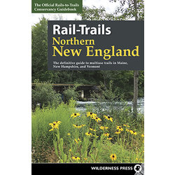
All across the country, unused railroad corridors have been converted to public multiuse trails. Here, the experts from Rails-to-Trails Conservancy present the best of these rail-trails—as well as other multiuse pathways—in Maine, New Hampshire, and Vermont.
Bucket-listers won’t want to miss Vermont’s 13.4-mile Island Rail Trail, which boasts a spectacular 2.7-mile marble causeway crossing Lake Champlain. Those who like short and sweet might check out the 2.1-Eastern Promenade Trail showcasing Portland’s Casco Bay and Portland Harbor, or for lengthier adventures, New Hampshire’s 58-mile Northern Rail Trail—the longest rail-trail in the state—offers a variety of wooded landscapes, waterside enjoyment, and welcoming small towns. Whether you’re on your feet, wheels, or cross-country skis, there’s something for everyone in this collection of multiuse trails in Northern New England.
$18.87
All across the country, unused railroad corridors have been converted into public multiuse trails. Here, the experts from Rails-to-Trails Conservancy present the best of these rail-trails—as well as other multiuse pathways—in Pennsylvania. You’ll appreciate the detailed maps for each trail, plus driving directions to trailheads. Quick, at-a-glance icons indicate which activities each trail can accommodate, from biking to fishing to horseback riding. Best of all, the precise descriptions are written by rail-trail experts, so you know it’s information that you can rely on!
Take a multi-day journey on the 152-mile Great Allegheny Passage, or enjoy a speedy out-and-back on the 4-mile Greater Hazleton Rails to Trails. Pennsylvania clocks in with 146 total rail-trails, so you’re sure to find the perfect route. Whether you’re on feet, wheels, or skis, you’ll love the variety in this collection of multiuse trails—from beautiful waterways and scenic areas to the hustle and bustle of the states’ urban centers!
$18.99
In this exceptional guidebook, author Linda Stager (herself a resident of Wellsboro) takes you on a mile-by-mile tour of the Pine Creek Valley via the Pine Creek Rail-Trail.
She shows you landmarks, tells stories about the history of the region, and imparts practical advice for a successful trip along the trail.
The Pine Creek Rail Trail is one of Pennsylvania’s destination trails, and for good reason. The 62-mile well-maintained trail runs at the bottom of super-scenic Pine Creek Gorge, commonly called the Grand Canyon of Pennsylvania.
The gorge runs 800–1,400 feet deep and a mile wide. A natural travel route through northern Pennsylvania for American Indians, the gorge in 1883 became the route of the Jersey Shore, Pine Creek and Buffalo Railway (later named Pine Creek Railway). The last freight passed through in 1988, and the trail was born in 1996 and extended to its present length in 2012.
$17.95
All across the country, unused railroad corridors have been converted to public multiuse trails. Here, the experts from Rails-to-Trails Conservancy present more than 50 destination rail-trails, as well as other multiuse pathways, in Connecticut, Massachusetts, and Rhode Island.
Within these pages, you can explore two Hall of Fame Rail-Trails: the Minuteman Bikeway with its rich historical connections to the American Revolution and the East Bay Bike Path with its quintessential New England waterfront views. You’ll discover trails that traverse the quiet woodlands of Connecticut and the charming communities of Rhode Island, and you'll learn about ambitious trail projects spanning multiple counties across Massachusetts, like the Mass Central Rail Trail and the Border to Boston Trail. These adventures and more await you on the many multiuse trails of the region.
Page 1 of 1